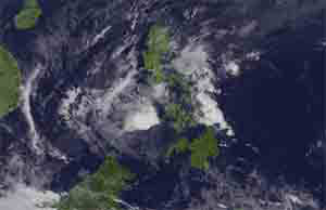
Stormy weather continues to prevail in most parts of Luzon including Metro Manila as Typhoon “Lando” has slightly weakened as it made its first landfall in the town of Casiguran, Aurora Province, the Philippine Atmospheric, Geophysical and Astronomical Services Administration (PAGASA) said.
PAGASA weather forecaster Buddy Javier said that as of 5 a.m., the eye of the typhoon was located in the vicinity of Casiguran, Aurora (15.9°N, 121.8°E).
Javier said typhoon “Lando” made its first landfall in Casiguran, Aurora around 1 a.m. which reduced its maximum sustained winds from 185 kilometers per hour (kph) to 175 kph near the center and also its gustiness from 220 kph to 210 kph.
He added the typhoon also slowed from 12 kph to only 3 kph on Sunday morning as continues to move westward.
He noted the cause of slow movement of the typhoon was due to the presence of High Pressure Area and also traverse in landmass.
Javier also said typhoon “Lando” will traverse the Cordillera Autonomous Region (CAR) and Isabela then will exit landmass in Cagayan by Wednesday or Thursday.
With slow movement, Javier said the typhoon will linger inside the country and once it exits, it will head towards east of Taiwan.
Meanwhile, Public Storm Warning Signal No. 4 hoisted over Aurora Province is still up, while signal No. 3 was raised in the provinces of Isabela, Quirino, Nueva Vizcaya, Nueva Ecija, Ifugao and Northern Quezon including Polillo Islands.
Signal no. 2 remained hoisted in Metro Manila, as well in the provinces of Cagayan including Calayan and Babuyan group of Islands, Benguet, Mt. Province, Kalinga, Apayao, Pangasinan, Tarlac, Pampanga, Bulacan, Rizal, and the rest of Quezon.
Signal no. 1 is up in Zambales, Ilocos Norte, Ilocos Sur, La Union, Abra, Camarines Norte, Bataan, Cavite, Laguna, Batangas and Batanes.
Provinces under signal no. 2, 3 and 4 will experience stormy weather while the rest will experience occasional rains and gusty winds.
Residents in low lying and mountainous areas of the affected provinces are also alerted against possible flash floods and landslides.
Storm surge in affected areas are expected to reach a height of up to 3 to 4 meters in Aurora and neighboring provinces while wave height in open sea may reach up to 14 meters or higher.
For Sunday forecast, PAGASA said stormy weather is expected over Metro Manila, Cagayan Valley, Cordillera, Central Luzon and the provinces of Rizal and Quezon including Polillo islands while rains with gusty winds will prevail over the Ilocos region, rest of CALABARZON and the provinces of Marinduque, Camarines Norte and northern part of Mindoro including Lubang islands.
Cloudy skies with light to moderate rains will be experienced over Visayas, Zamboanga Peninsula and the rest of Luzon and partly cloudy to cloudy skies with isolated thunderstorms will prevail over the rest of Mindanao.
Moderate to strong winds blowing from the northeast to northwest will prevail over the rest of Luzon and coming from the southwest over Visayas and Mindanao with moderate to rough seas.
The state-run weather bureau also issued a gale warning due to the effects of the typhoon as the sea condition would be rough to very rough due to strong to gale force winds expected to affect the seaboards of Luzon and Visayas and the Northern and Eastern seaboards of Mindanao. (PNA)

- Ang mga Masisipag na Magbabade - June 30, 2026
- Ang Mga Magbabade ng Isda, Part 2 - June 29, 2026
- Ang Mga Magbabade Sa Pagawaan Ng Tuyong Isda, P1 - June 28, 2026