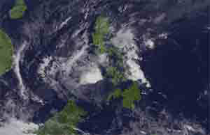
Batanes island group was placed under tropical cyclone signal 4 on Tuesday evening as typhoon ‘Ferdie’ approaches the area.
The state weather bureau, Philippine Atmospheric, Geophysical and Astronomical Services Administration, in its midnight bulletin warns that the typhoon will make its first landfall in Batanes between 11:00PM and 1 AM.
The howler is expected to exit the Philippine area of responsibility (PAR) around 10AM to 12PM of Wednesday.
PAGASA said the typhoon will be located 375 km west northwest of Itbayat, Batanes by Wednesday morning.
The rainfall is expected to range from moderate to heavy in the typhoon’s 600 kilometer (km) diameter, the weather agency said.
The province of Ilocos Norte, Apayao, and areas in Northern Cagayan are placed under signal 2, with 61-120 kph winds expected in 24 hours.
Other possible areas which will experience the weather disturbance include the rest of Cagayan, northern Isabela, Kalinga, Abra and Northern Ilocos Sur with signal 1. It will experience 30-60 kph winds in the next 36 hours.
As of 10 p.m., the typhoon’s eye was located at 60 km east of Basco, Batanes (20.5°N, 122.5°E). The typhoon is estimated to move west northwest at 24 kph.
The typhoon has a strength of maximum sustained winds of up to 220 kph near the center, with a gustiness of up to 255 kph. (PNA)

- Eco-airport of Bohol Panglao International opens for commercial flights - November 30, 2018
- Award for Mocha came from alumni group, not from UST - January 22, 2018
- Delos Santos stays as BuCor chief despite resignation, but for a while - July 17, 2017