The province of Catanduanes is now under public storm warning signal no. 1 as tropical depression Santi has intensified into a tropical storm expected to stay within the country’s territory until weekend, according to the Philippine Atmospheric, Geophysical and Astronomical Services Administration (PAGASA).
PAGASA defines a tropical storm as moderate tropical cyclone with maximum wind speed of 64 to 118 kph (25 to 75 mph).
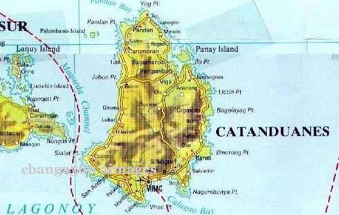
Weather Forecaster Alvin Pura said that as of 4 a.m. the center of tropical storm Santi was located at 400 km east of Virac, Catanduanes (14.8°N, 128.2°E) packed with maximum winds of 75 kph near the center and gustiness of up to 90 kph.
Pura said that Cantanduanes is now under public storm warning signal no. 1 (30-60 kph winds may be expected in at least 36 hours).
PAGASA advised residents of areas under Public Storm Warning Signal #1 are alerted against possible flashfloods and landslides.
“Santi” forecast to move west northwest at 11 kph.
Pura noted that if Santi maintains its present directionand speed, it is expected to make landfall in Central and Northern Luzon on Saturday.
He said they also expect Santi to further intensifybefore hitting the land.
He added that in the next 12 to 24 hours Santi is expected to intensify since its in the sea.
He added areas within its 300-km diameter of tropical storm will experience rains amounting from 5 to 30 millimeters, which is classified as “moderate to heavy.”
Pura said Santi is expected to linger in Philippine territory until weekend and will likely exit the Philippinearea of responsibility (PAR) on Monday or Tuesday headed towards Vietnam.
Santi is forecast to be at 190 km northeast of Virac, Catanduanes by Friday morning.
It is expected to be at 140 km east of Baler, Aurora by Saturday morning and also expected to be in the vicinity of Pangasinan by Sunday morning.
Pura said parts of Luzon, including Metro Manila, arealready expected to have passing light to moderate rains Thursday because of the outer cloud bands of the tropical cyclone.
Visayas and Mindanao, on the other hand, he noted willalso experience light to moderate rains, not because of Santi but due to the Intertropical Convergence Zone (ITCZ).
Meanwhile, Pura said the agency is also keepingwatch on another weather disturbance over the Pacific Ocean that may enter the country on Monday.
He said it has a “potential” to become a cyclone “within24 to 48 hours.”
Once it enters the PAR as a cyclone, Pura said itwill be named “Tino.”
However, he noted that just like typhoon “Ramil,” it willonly stay briefly in PAR and is not expected to hit the land in any part country.
Earlier, PAGASA said it expects two to three cyclones toenter the country this month.
In its Thursday advisory, PAGASA said that Catanduanes will have rains with gusty winds with moderate to rough seas. The rest of Bicol region will experience cloudy skies with moderate to occasionally heavy rainshowers and thunderstorms which may trigger flashfloods and landslides.
It added that Metro Manila, Calabarzon (Cavite, Laguna, Batangas, Rizal and Quezon), Mimaropa (Mindoro, Marinduque, Romblon and Palawan) Visayas and Mindanao will be cloudy with light to moderate rainshowers and thunderstorms.
The rest of the country will have partly cloudy to cloudy with isolated rainshowers or thunderstorms.
The weather agency added that light to moderate winds coming from the north to northwest will prevail over Luzon and blowing from the northwest to southwest over the rest of the country. The coastal waters over the entire archipelago will be slight to moderate.
PAGASA issued gale warning as strong to gale force winds associated with Tropical storm “Santi” is expected to affect the eastern seaboard of Visayas.
“Fishing boats and other small sea crafts are advised not to venture out into the sea while larger sea vessels are alerted against big waves,” it said. (PNA)

- Road Tour Calabanga:San Pablo to Amang Hinulid - August 31, 2022
- Miss U Catriona Gray Rumampa ng Suporta sa Tropa - May 9, 2022
- Dalawang Shoutout SOX People’s Rally for Leni - April 4, 2022